Equinox Marathon 2 days to go
With two days to go, I'm pretty set but also resigned to not being 100%. Other than missing maybe two or three workouts due to vacation travel, training could not have gone better this summer. I got in the requisite long runs and marathon pace workouts, and logged in about 580 miles during July and August. At 48 just getting to the marathon starting line in one piece is half the battle. Nevertheless, my hip flexors started acting up during taper--things seem to happen during cutbacks--and this Tuesday I started experiencing a bit of a sore throat with ensuing cold symptoms. Neither of these are show stoppers, but may slightly compromise the outcome. I think that a sub 3:05 is still possible, but going for 3:00 would be tough. The plan is to get out on the course, find a flow, and run smart. It's going to be a challenging day, but at this stage in my running career I've got the mental game down.
Below is a bit of a photo-essay describing the course (photos borrowed from Running Club North).
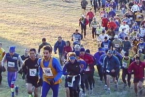
The Equinox starts on a soccer field at about 500 feet elevation, but within seconds you realize that this will be no ordinary marathon. The first climb starting at 150 yards is a slap in the face, as you must surmount a 200 foot climb over the next quarter mile.
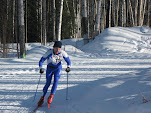
For the next 4 miles the course winds up and down on ski trails and paths, with a little road work, and climbs to about 850 feet at mile 4 before continuing with a net downhill until you reach Sheep Creek Road at about 600 feet, between mile 7 and 8. At this point you've already run a challenging course, with a level of difficulty comparable, if not tougher, to the famed Van Cortland Park in New York City. Yet at 8 miles the fun hasn't even begun! The next mile is a steady climb on pavement.
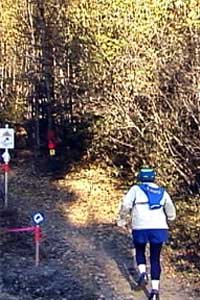
Just after mile 9, at the first relay exchange, runners start their climb to the top of Ester Dome, where the course climbs from 700 to 2,300 feet in 3.4 miles.
[9.5 miles, heading to the steepest 1/2 mile of the course]
[12 miles, still climbing]
At 12.4 the grueling climb subsides, but there are miles to go. Firs they follow the ridge on the "out and back," which heads about 2.4 miles west, droping 400 feet, and then back up on the same trail. It's mostly a rutted gravel 4WD trail but some is on a path. On a clear day you can see Mount McKinley.
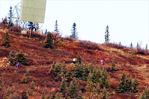
[12.7 miles, after a short respite, runners climb onto the tundra for one last climb to the 2nd Ester Dome summit]
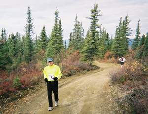
[15 miles, the out and back, the loneliest stretch of the course]
At 17 if you haven't been fatigued for a while already, you'll be there soon. A nice gradual downhill back into Fairbanks would be the right way to wrap up this race, but it's founders were cruel. First you must navigate "The Chute," which plummets down a power line for about 400' feet over maybe 600 meters. Treacherous is an understatement. The Chute is covered with loose gravel and jagged soft-ball sized rocks. At best it's about 4 or 5 feet wide, with 10 inch ruts on either side. What were they thinking!?
If you can make it through The Chute then you can enjoy best part of the course, which flows from mile 17.5 to 20, most of it descending steadily through aspen and birch groves.
By 20 you'd want a nice gentle trail or gravel road to take you home, but no, nothing is easy on the Equinox. You have 2 miles of moderately steep downhill...on pavement. There is a bit of respite on the 23rd mile where the course turns onto a gently rolling power line trail. At 23 it's back to pavement, with an easy 2-4% downhill grade on Gold Mine Road. The road is straight but boring.
Just before mile 25 you cross Sheep Creek Road onto the UAF ski trails, where you must make a few more steep climbs over the next half mile. What would have been easy a few hours ago is simply more torture. Only over the last 3/4 mile do you get an easy shot into campus and back to the finish.


0 Comments:
Post a Comment
Subscribe to Post Comments [Atom]
<< Home