PreludeMany friends and family think that we were crazy to move to Alaska from Colorado in 2004. Indeed our initial response when I was offered a transfer was that at best this was a joke or, more worrisome, manipulation by my employer to get rid of me. Who cares about the latter anymore, this has turned out one of life’s best adventures!
We moved back to Colorado in 1998, after a decade of skipping around the U.S. in my quest for work and education in wildlife science. However, within days and weeks of arriving that year we realized that the Colorado we had left was no longer: sprawl, traffic, and rude-hypocritical politics of the ruling party had taken what had been a laid back athletic/outdoor mecca into a paved, snarled, burgeoning megalopolis. Tamara and I decided that, although we would miss our many friends and our parents, we no longer wanted live there and bring up our family in that cluster-fornicated environment. A clincher for me was the rapid closing down of recreational access, which included increased restrictions on public “Open Space” lands. Alaska was our future. The following pictures and captions chronicle our move to Fairbanks during the spring of 2004. 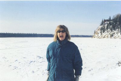
March 2004. We're moving to Fairbanks! Tamara at the edge of the Tanana River on our decision visit to Alaska. We arrived at 2:30 AM when it was -23 F, but decided to make the subarctic leap anyway.
May 2004. In the first of two road trips to Alaska that spring I drove 3,100 miles on my own to start work and look for a place to live. Even though I took the fastest route, that trip took almost five 10 to 14 hour days, which gave a lot of time to reflect on the past and ponder the future, and catch up on some books on tape. A few weeks later I flew back to Colorado for an encore. The plan was to take the scenic route through Yellowstone and Glacier National Parks and the Canadian Rockies.
Goodbye Colorado, Hello Road
June 10, 2004. The Honda was packed to crawling room only as we prepared to start our trip with kids, Kaija our spoiled Siberian husky and Whiskers a fat and insouciant house cat. Leaving carries mixed emotions from what has been home for more than twenty (albeit dispersed) years. However, such thoughts passed quickly as we crossed into the grassland and sagebrush steppes of Wyoming. We drove through the vast lands under blustery skies that turned threatening as we approached Dubois, in the northwest part of the state. We stayed a a motel, which was a good decision because it rained violently through the night.


June 11, 2004.
The plan was to go to Yellowstone, but we were thwarted just a quarter mile from the gate after sitting in a traffic jam for more than an hour. The rain had turned to snow overnight, and the Park Rangers decided to shut down entry into the entire Park for the morning, if not the rest of the day. This meant we had to turn around and drive to Jackson through rain and snow, and then over a treacherous Targhee Pass into Idaho, where it continued to rain and rain some more. The rain did not let up until we crossed into Montana. Brokeback country, with it's arcane cowboy culture, interspersed with huge ranches owned by the rich and famed. After an exausting 14 hours, we finally arrived to Missoula, still a nice town, but the stretching expanses of tract homes, strip malls, and box stores were overtaking the valley.
June 12, 2004. Finally the weather had cleared enough to see a little. We went to the National Bison Refuge for a morning visit. Although we did not see any bison, we did se an cow elk (pictured minutely along the fence). She had probably just calved and was trying to distract us away from her newborn. A few miles up the road was the town of St. Ignatious, where my parents had lived for a ti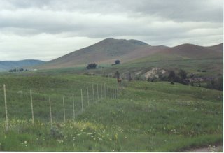 me when my dad worked for the Bureau of Reclamation. I have a brother there, but he never saw the towering rampart of the Mission Range shooting up to the east of the village because he died at birth 50 years before. In a way his death gave me life, because would I have been four years later born if he had lived? I wanted to let him know that I miss him. We did not find his gravesite, but I will return there someday.
Not until after we passed through Kalispell did it seem like we were finally getting away from the bustle of 21st century America. We also left the steppe and entered into a continously mountainous region. Glacier National Park was socked in heavy clouds. Forget that. We pressed on toward the Canadian border. At the border, I made sure Tamara was driving. On my first trip in May, I was detained for an hour at I-15 into Alberta. Two Canadian border agents, a man and a woman, searched my car, and they were almost accusatory: "If you have anything, you had better claim it now!"
"Sir, sit here! I said HERE, sir! We must see you while we search!"
But all that they found were a couple of bags of running gear, which generated some mild intereset, enough to make them lighten up a little. "So you're a runner, eh?" asked the lady border agent. The also delved into several boxes containing dozens of wildlife journals. Scientific contraband.
Usually, Tamara only needs to smile, and she can go anywhere. Sure enough, they didn't even stop us into Canada.
British Columbia was rustic and non-pretentiously laid back. We drove for a couple hours between the jutting Purcell and Kootenay ranges. The sky cleared were finally able to camp at Wasa Lake, BC.
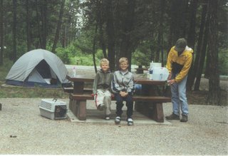
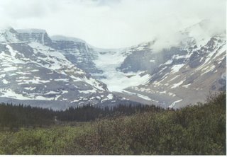
June 13, 2004. This day was one of the highlights of the trip. After an easy run around Wasa Lake we headed north along the Kootenay Range, past Radium Hot Springs and into Kootenay National Park. I think this area is one of the most beautiful in North America and one of its best kept secrets. The highway intesected between Canmore (where the 1988 Olympic cross country events were held) and Lake Louise. This is the Ice Fields Highway, sided by jagged peaks, hanging glaciers, and blue green lakes. The clouds broke through and socked, lending a mystical air to our northward trek. The amazing thing was that this was on a weekend in June--traffic was light to almost non-existent. The two hours to Banff went by too quickly. Someday it would be great to return here and meet some friends to run the 170 mile Jasper to Banff Relay. 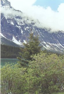
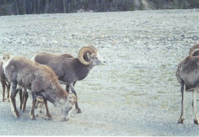
So far we hadn't seen much wildlife along the way, other than some pronghorn in Wyoming and Montana and the occassional mule deer or elk. That changed as we headed out of Jasper, toward Mount Robson Provincial Park and the Fraser Valley. First we saw a band of Rocky Mountain bighorn sheep, foraging right along the road. I had spent three years researching a transplanted herd of California bighorn sheep in North Dakota. With the exception of the fall rut, you usually could not approach those within a couple hundred meters of those bighorns before they dispersed at a full run. But in Jasper, they were quite tolerant as long as you stayed in your vehicle, or if on foot provided them a respectful distance (unfortunately, even in Canada, many people don't realize that).
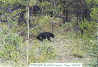
 As we cascaded westward and dropped in elevation, toward Prince George, bear sightings became frequent. The cliche image of a slow-moving, lumbering beast could not be more inaccurate. Bears are amazing athletes and physiological wonder-critters. These bears were always moving, moving, moving--seemingly oblivious to the traffic--in search of food, or in the case of young males, suitable space to stake their claim in life. We camped along the Fraser River about two hours east of Prince George.
June 14, 2004. We simply drove a long-long way and it rained much of the time. We momentarily considered taking the Cassiar Highway, which is remote and scenic but also time-consuming. Considering the weather, we decided to take the faster route. Passed through Prince George in the morning and pressed on, finally reaching Alaska Highway in the afternoon, near Fort Saint John 57 miles into the 1500 mile highway from Dawson Creek to Fairbanks.
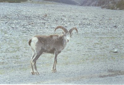
June 15, 2004. After a chilly night we got up early to get ahead of RV traffic and hopefully to see some wildlife in Stone Mountain Provincial Park, and Muncho Lake, a few more miles up the road. After cres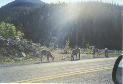 ting a pass, the highest point on the Alaska Highway, we came upon a new bighorn species, Stone's sheep. These "thinhorn sheep," one of two northern subspecies are found only in British Columbia and southern Yukon. They tend to be slate gray with a striking white band along their rear. Their cousin, the Dall sheep, found in the Yukon and Alaska only, is all white. The thinhorn species tend to be less robust than the Rocky Mountain bighorns to the south.
We had a few minutes to take some pictures before someone drove up in an RV and stepped out, forcing the animals to move on.
However, just a few more miles down the road we saw another group, including this young ram. If it was a Rocky Mountain or California bighorn he'd look about two years old, but the northern sheep grow slower because of their sparse diet and long winters, so this ram might be three or four years old). Due to their striking coloration and habitat Stone's sheep are my favorite bighorns.
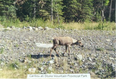
The wildlife viewing opportunities in Stone Mountain and Muncho Lake Provincial Parks are hard to beat, if you're willing to make the drive. Just after encountering the Stone's sheep we started seeing the first scattered groups caribou.
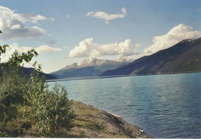
This day's drive through northern British Columbia and southern Yukon was the best of the trip. Every turn brought a new sight. We took a short hike near the Rancheria River to stretch our legs a catch a view of the valley. Looking west we could see the valley stretch out for miles from its source. And to our west was a geologic formation known as a Hoodoo. Eroded clay formations. I was just telling the family how this reminded me of the badlands where I studied bighorn sheep, when over the top of the Hoodoo, poked the head of a ram (you can see a little dot on the upper reaches of the Hoodoo. That's the ram.).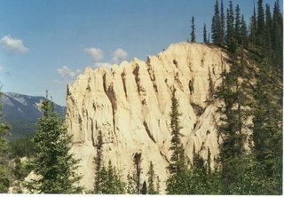
We 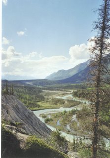 camped a couple of hours east of Whitehorse at a nearly deserted campground. The only other users that night were a couple of drunk, or getting that way, students from Vancouver, who had been driving 36 hours straight on their way to Alaska. MacKenzie Brothers Northwest. Heading the opposite way was a quiet young woman who was biking from Alaska to Washington state--don't know if it was exhaustion, the solitude, or what, but she wasn't all there.
June 16, 2004. It rained most of the night. Kaija the husky slept in the car, but peed on seat because she was irritated at a stray dog in the campground. We notified the Ranger about the dog but couldn't do much about the pee. With more than 600 miles to Fairbanks, we didn't have much time to sightsee, but stopped in Whitehorse for a while to visit some tourist shops. Somewhere around there the cat escaped its kennel, sending us all into mini-van pandemonium. It was time for this road trip to end.
The Yukon is North America's best secret. It's the size of California with only 60 thousand or so inhabitants, and the majority live in Whitehorse or nearby. A couple hours northwest of Whitehorse lies Haines Junction. Not much there except one of the most awesome backdrops on the continent. The picture below depicts 19,500 foot Mount Logan reposed behind a couple of 15,000 mountains. The Town of Haines Junction is only a couple thousand feet in elevation. These mountains make Colorado or Montana look like Appalachia.

The next hour or two, into Kluane Lake National Park, also offer incredible mountain and lakeside scenery. They've been upgrading the highway through there for 20 years or more, and they're still not done. They have a Dall sheep viewing area in Kluane, but the animals were in the out of sight in the high country.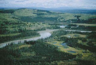
As we entered into the Alaska, we made sure Tamara was at the wheel. Again, they didn't even stop us. Blondes, a sure way to bypass the Border Patrol. At this point we just wanted to get to Fairbanks, still almost 300 miles away. However, the passage along this portion of the Alaska Highway is also the major flight corridor for migrating birds. We were a month or two behind them, but we knew that our stay would be longer than a few months out of the year (picture of Tetlin National Wildlife Refuge, near Tok, courtesy of U.S. Fish and Wildlife Service).
2006
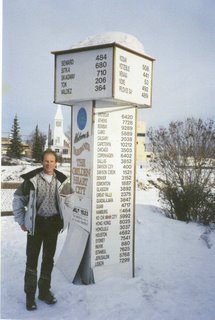 So two years later, we're still settling in. Our only regret is that we didn't move here years earlier. Fairbanks is a small town of about 50,000 - 60,000 that can be seen as either at the edge of the modern world (everything else north and west are more or less outposts), or an island in a vast boreal and montane sea. We have six months of winter and, since our arrival, smoke from huge wildfires have blotted the summer sky for a month or two at a time. We're far from friends and family. However, here we have a community. People actually look out for each other and they are usually respectful of differences amongst themselves. Heavy traffic is a couple dozen cars waiting at signal light at 5 PM. I'm also glad to be geographically separated from the political forces and irritating personalities that run roughshod down in the lower 48. I look forward to many years of adventure here.
(with the exeption of Tetlin NWR, all were photos by Roger and Tamara Sayre)


